
In today’s fast-paced design environment, speed and convenience often take center stage. For many design and engineering teams, downloading freely available Revit families feels like a simple way to accelerate modeling tasks. But behind that convenience lies a silent threat — one that impacts performance, consistency, and even project profitability. Forward-thinking firms have learned that the real cost of free content is hidden in the hours spent fixing, coordinating, and reworking models. Let’s explore why Free Doesn’t Mean Fit-for-Purpose Most Revit families available online are created for general use — not your firm’s specific standards, workflows, or project requirements. They might look perfect in isolation, but once integrated into your model, they often fail to align with design parameters or client deliverables. The result? Revisions, replacements, and endless coordination calls. Data Consistency Is the Foundation of BIM A well-managed BIM environment depends on reliable, standardized data. When you import families from multiple sources, you inherit their inconsistencies — mismatched parameters, naming conventions, and data fields. Over time, this disrupts schedules, quantity of take-offs, and data analytics. What begins as a few shortcuts quickly snowballs into a loss of data trust across the organization. Model Performance Suffers in the Long Run Revit families downloaded from unknown sources often carry excess geometry or unnecessary nested elements. These increase file size, slow down model performance, and lead to instability in large, multidisciplinary projects. Instead of improving productivity, they quietly reduce it — especially when multiple teams collaborate in a shared environment. Compromised Quality = Increased Risk For firms working under ISO 19650 or similar frameworks, every BIM object carries a quality responsibility. Poorly structured or unverified families introduce risk — not just in design coordination but in contractual deliverables. What may seem like a harmless symbol can later cause documentation errors or compliance failures, directly impacting client confidence. Efficiency Comes from Control, Not Convenience The most successful BIM teams don’t rely on what’s free — they rely on what’s verified. By developing a centralized BIM content library, firms can control naming, parameters, geometry, and metadata — ensuring every family performs predictably across projects. This level of consistency doesn’t just save time — it strengthens trust between teams and clients alike. The Smarter Way Forward DGTRA’s BIM Content Management Services help organizations move beyond ad-hoc Revit downloads toward structured, high-performance content ecosystems. Through standardized templates, QA validation, and metadata optimization, DGTRA enables teams to deliver faster, maintain compliance, and reduce rework — all while improving model stability. Conclusion The truth is simple: free Revit families aren’t really free. They come with hidden costs — time, errors, and lost confidence. Leading firms are redefining BIM efficiency not by cutting corners, but by building stronger foundations of data, consistency, and control. And that’s exactly where the future of intelligent design begins. Are free Revit families always bad to use? Not necessarily—but they are rarely suitable for enterprise or large-scale BIM workflows. Most free families are built for generic use, not aligned with firm-specific standards, project LOD requirements, or ISO-compliant data structures. Without validation, they often introduce inconsistencies and rework. What hidden costs do free Revit families create? The biggest costs are not financial upfront—but operational over time. Teams spend hours fixing parameters, correcting geometry, resolving coordination clashes, and troubleshooting performance issues. These hidden inefficiencies directly affect delivery timelines and profitability. How do poor-quality families impact BIM data and deliverables? Inconsistent or poorly structured families compromise schedules, quantity take-offs, and downstream data use. When BIM data can’t be trusted, it weakens decision-making, reporting accuracy, and client confidence—especially on data-driven or asset-focused projects. Why is BIM content quality critical for ISO 19650 compliance? ISO 19650 requires controlled, reliable information management. Unverified families introduce risk in naming conventions, parameters, and data integrity—potentially leading to non-compliance, documentation errors, and contractual issues. What is the advantage of investing in a managed BIM content library? A managed BIM library ensures consistency, performance, and predictability across all projects. Standardized geometry, parameters, and metadata reduce rework, improve collaboration, and enable teams to scale BIM delivery with confidence—without sacrificing quality.
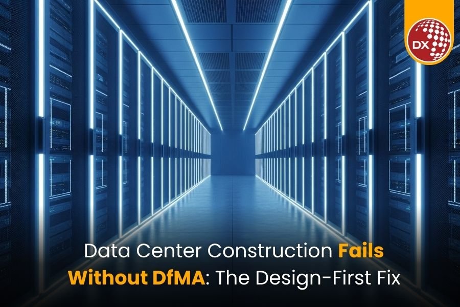
Data Center Construction Fails Without DfMA: The Design-First Fix | UK & USA
Most modular projects fail long before reaching the factory floor, and not because of fabrication. It is because DfMA was never embedded into the design. A simple search of the internet will show data centers and critical facilities in the UK and USA are using modular construction to streamline construction time. Standard practices include using prefabricated modular MEP skids, modular electrical rooms, containerized utility plants, and modular technical spaces. Even with the use of modular data center construction in the UK and USA, many projects still face: Design rework Factory delays Site coordination clashes Extended commissioning cycles Construction is rarely the root cause of these issues. Instead, it’s the design workflows not optimized for DfMA-based construction in UK and USA projects. At DGTRA, we consistently see that construction speed is impacted by decisions made long before the project breaks ground. These decisions are made during the initial phases of design and delineate the success of manufacturing and assembly. DfMA Starts in Design — Not in the Factory While Design for Manufacture and Assembly (DfMA) is often misconstrued as simply a fabrication tactic, the abbreviation real essence of the abbreviation emanates from the design as the prime focus. In data centers and critical facilities across the UK and USA, key design choices made early on dictate: Module size and transport limitations Design and access strategies for plant rooms MEP integration scope Sequence of installation Logic of handover for commissioning and operations If design progresses while these considerations are absent, it is only a matter of time before modular execution shifts from a strategy to a reaction, and in doing so, creates risk instead of eliminating it. By the time the manufacturing process is set in motion, lost time becomes a void from which recovery is simply not possible. Developers of mission-critical facilities in the UK and USA are increasingly tasked with: Accelerating time-to-market Quickly scaling capacity Uptime and redundancy Capital risk Predictable delivery timelines Why Modular Construction Alone Doesn’t Deliver Speed Production acceleration through prefabrication occurs only when: Construction modules are designed with UK & USA manufacturing limitations in mind Standard interfaces between combined disciplines BIM models contain required construction and production intelligence Plans and strategies are constructed for logistics and lifting Design data includes construction sequences Without DfMA-driven design for UK and USA modular data centers, modular construction becomes an isolated production activity rather than an integrated delivery strategy. At DGTRA, we summarize it simply: A BIM model built only for visualization is a digital liability. A BIM model built for manufacturing and assembly is a delivery engine. Common Design & Coordination Bottlenecks Across data centers and complex facilities in the UK & USA, we observe the following recurring challenges: Lack of coordination between the architectural, structural and MEP design Absence of modular logic when developing BIM Late involvement of fabricators Team data standards that lack uniformity Layouts for Technical Rooms That Cannot Be Repeated Exclusion of Design Commissioning Requirements These are workflow and governance issues, not technological issues. What DfMA-Ready Design Workflows Look Like DfMA workflows integrate design, manufacturing, and construction from the outset. A modular approach is set at concept design. Design rules incorporate UK & USA manufacturing limitations. BIM serves as a manufacturing data backbone. Preliminary engagement with fabricators and installers. Uniform typologies for technical spaces and plant rooms. Design Logistics and Assembly planning is complemented by construction sequencing. This changes BIM from a tool for visualization into a tool for production and commissioning — essential for DfMA-based modular construction projects in the UK and USA. The Need for Integration While mission-critical data centers in the UK & USA are being built, there is a need to integrate the BIM/VDC team along with MEP and systems designers, modular fabricators, construction and installation teams, and commissioning and operations teams. When all stakeholders work together in a DfMA environment, there is minimal rework, and procurement, factory production, and site installation are all optimized and sequenced — leading to accelerated commissioning. The result is the ultimate “real speed” to commissioning and not just faster construction. The Balancing Act of Standardization When streamlining operations, a primary concern is that standardization will eliminate opportunities for flexibility. However, through systemized design, scalability is achieved. By creating repeatable module libraries, configurable design templates, and setting standards for interfaces and expandable frameworks, organizations can rapidly deploy new system designs to an operational capacity without a complete redesign — a key differentiator for DfMA-led construction in UK and USA data centers. From an executive perspective, this provides lower design costs, faster replication, decreased program risk, and predictable performance outcomes. The Business Impact Projects that utilize DfMA-based design for data centers in the UK and USA can expect shorter design-to-factory cycles, no mid-production redesigns, faster procurement, and assembly on site. This leads to early revenue realization. In environments where there is no room for downtime, DfMA becomes a strategic advantage in the UK and USA for mission-critical markets. Why This Matters Now The current global need for data centers in the UK & USA has created a surge in modular construction adoption, which is only part of the solution. To truly transform construction, design workflows must be addressed. The ability to embed DfMA from the design phase will shape the next frontier in: Delivery speed Cost efficiency Operational reliability Growth potential The design will dictate the future of mission-critical delivery, not construction sites. Join DGTRA’s Upcoming Webinar To assist industry leaders in closing the design-to-delivery gap, DGTRA will host an exclusive webinar for UK & USA Data Center professionals on Modular Strategies & Design Optimization for Data Centers & Complex Facilities. What you will learn: Why modular construction does not guarantee faster delivery. Frequent design and coordination bottlenecks. DfMA-ready, first design workflows. Synchronizing the BIM, MEP, manufacturing, and construction. Who should attend: Data Center Design Managers, BIM/VDC Leads, Construction Managers, Program Directors, Operational Managers, and Modular Delivery Teams from the UK & USA regions. 👉 Registration is now open. Reserve your spot to learn how to embed DfMA in design for predictable and accelerated commissioning. 👉 Register Now: DGTRA Webinar Final Thought The method is modular construction. The multiplier is DfMA-driven

From Topographical Survey Drawings to Digital Twins: Building Long-Term Asset Intelligence
From Topographical Survey Drawings to Digital Twins: Building Long-Term Asset Intelligence Key Takeaways Topographical Survey Drawings are the first layer of a digital twin, not just a pre-design formality. When captured as BIM- and GIS-ready data, topo surveys become a reusable asset for master planning, expansion, and scenario modeling. High-quality terrain data powers flood risk, drainage, and resilience simulations, instead of sitting as static PDFs. Linking topo data with BIM and Digital Twin platforms turns it into operational intelligence for inspections, O&M, and long-term asset decisions. Standardized, portfolio-wide survey practices help owners and agencies move faster up the digital twin maturity ladder and get more value from every new project. Beyond “One-and-Done” Topo Surveys For many developers, asset owners, and public agencies, Topographical Survey Drawings are treated as a pre-design checkbox. You commission a survey, get a DWG and a PDF, design your project, and move on. But if you’re talking about digital twins, you’re already thinking longer term. You want a living digital representation of your asset that supports planning, operations, resilience, and future expansion. That digital twin doesn’t start with IoT sensors. It starts with the first time you measure the ground. The question is: are your topographical surveys captured and structured in a way that your future digital twin can actually use? Topographical Survey Drawings = Foundation Layer of the Twin A digital twin is only as good as its base geometry and coordinate framework. That base doesn’t come from design intent; it comes from the real-world terrain and assets your project sits on. Modern digital twins for infrastructure and cities depend heavily on: High-resolution topographic data Consistent coordinate systems and control Survey-grade elevation and feature mapping Integration with GIS and BIM environments If your Topographical Survey Drawings are just flat 2D linework with unclear benchmarks, they limit what you can do later. If they are BIM-ready, geospatially robust, and properly attributed, they become the foundation of: Accurate terrain models Flood and drainage simulations Utility and corridor planning City- or campus-scale digital twins Where Topo Data Adds Long-Term Value 1. Master Planning and Future Expansion High-quality site topographic mapping and contour plans allow planners to: Evaluate multiple land-use and phasing options on real terrain Test different access roads, platforms, and grading schemes Preserve future expansion zones without creating hidden earthwork problems In a digital twin, those same surfaces become the canvas for scenario modelling—what happens if you add another terminal, data hall, or warehouse block in 10 years? 2. Flood Risk and Climate Resilience Recent digital twin pilots for cities and coastal assets show strong use of terrain and hydro data for flood modelling and resilience planning. If your 2D and 3D topographical survey plans capture: Fine-level elevation changes Drainage channels and basins Shorelines, embankments, retaining systems …those details enable your digital twin to run: Flood depth and extent simulations Stormwater performance tests “What-if” scenarios under future climate projections This is impossible if the original survey is simplified, generalized, or locked away as a static PDF. 3. Operations, Inspections, and O&M Analytics Digital twins are increasingly used for asset management, inspections, and predictive maintenance. If your base terrain and as-built surveys are: Properly aligned to your asset registry Linked with building and network models Stored in a reusable BIM/GIS environment Then you can: Plan safe access routes for inspections Understand where water will pond or scour Tie defects and incidents back to specific terrain conditions Topographic data stops being “design history” and becomes part of the O&M intelligence layer. Digital Twin Maturity: Where Topo Surveys Fit Think of a simple digital twin maturity ladder: 1.Stage 0 – Isolated Files a.Topo survey lives as a one-off DWG/PDF in a project folder. 2.Stage 1 – Connected BIM / GIS Base a.BIM-ready Topographical Survey Drawings feed your BIM and GIS models. b.Terrain is consistent across design disciplines. 3.Stage 2 – Program-Level Digital Twin a.Multiple sites or corridors share common survey standards. b.You can compare risk, flood, access, and capacity across assets. 4.Stage 3 – Live Asset Twin a.Real-time or periodic monitoring (IoT, remote sensing) is layered on top of the survey-based geometry. b.You can ask “what-if” questions about operations, resilience, and investment. Your topographical survey strategy largely determines how fast you can move up that ladder. What This Means for Developers, Owners, and Public Agencies If you are commissioning surveys today, but talking about digital twins tomorrow, three action points matter: Specify BIM- and GIS-ready deliverables Ask for Topographical Survey Drawings in formats that support 3D surfaces, attributes, and coordinate metadata—not just 2D CAD. Standardize across your portfolio Use common layers, codes, and coordinate systems for every project. This turns individual surveys into a connected data asset for your entire estate or network. Choose partners who think beyond the current project Look for teams who understand both topographical survey drawing services and digital twin requirements, so every new survey strengthens your long-term asset intelligence. How DGTRA Fits into This Picture DGTRA sits at the intersection of: Topographical Survey Drawings and civil engineering BIM, VDC, and GIS integration Digital Twin support and implementation for owner-operators and infrastructure programs We help you convert raw terrain data into BIM-ready, portfolio-consistent survey models that can plug directly into your digital twin roadmap—whether you are planning a single site, a campus, or a city-scale infrastructure program. If you’re planning a digital twin initiative and want to ensure your next survey adds value for the next 30 years—not just the next 30 weeks—this is the moment to revisit how you brief, receive, and manage topographical data. Contact us to get started: https://www.dgtra.com/contact/ Are Topographical Survey Drawings really important for digital twins? Yes. High-quality topographic data forms the geometric foundation of any digital twin, enabling accurate simulations, planning, and long-term asset intelligence. What makes a topo survey “BIM- or GIS-ready”? A BIM/GIS-ready survey includes proper coordinate systems, attributed features, 3D surfaces, and structured layers that can be directly integrated into BIM, GIS, and digital twin workflows. Can existing 2D topo surveys be upgraded for digital twin use? To a certain extent, yes. DGTRA can convert legacy surveys into standardized, geospatially aligned models—but fresh, BIM-ready capture always yields the best results. How does topo data support flood resilience and climate modeling? Detailed elevation, drainage patterns,

Why Master Planning Support Services Drive High-Return Projects
Why Master Planning Support Services Drive High-Return Projects Key Takeaways Master Planning Support Services accelerate smarter decision-making, protecting ROI from day one. Data-backed master plans and feasibility studies eliminate guesswork, unlocking optimal densities, yields, and phasing strategies. BIM, VDC, and GIS–enabled workflows create a connected digital ecosystem that flows seamlessly into design and construction. Coordinated site and infrastructure planning reduces redesign costs and prevents on-site surprises. DGTRA provides investor-ready planning solutions that align architecture, infrastructure, and program goals to strengthen long-term asset value. Unlocking ROI with Master Planning Support Services Real estate and infrastructure projects face increasing pressure, tight margins, cautious capital, and rising expectations for performance. In this environment, early planning decisions directly influence IRR. Master Planning Support Services transform planning from a sketch exercise into a strategic, ROI-driven engine. By combining feasibility analytics, capacity testing, infrastructure validation, and digital coordination, these services allow teams to: Test multiple scenarios Optimize land use and density Refine phasing strategies Validate infrastructure capacity Understand capital implications early A strong master plan ensures: Efficient land utilization Optimized product mix Infrastructure cost control Faster regulatory approvals Predictable long-term development For organizations managing multiple projects, this becomes a core investment strategy—helping leaders select the right projects, sequence them wisely, and make decisions backed by data, not intuition. What Are Master Planning Support Services? Master Planning Support Services bring structure, clarity, and digital intelligence to the earliest and most crucial phase of development. Instead of one static layout, teams receive coordinated, data-driven scenarios backed by feasibility logic and engineering constraints. Key components include: 1.Strategic Planning & Visioning Visioning, growth strategy, and market alignment Early feasibility and financial benchmarking 2.Site & Context Intelligence GIS-based site analysis and constraints mapping Environmental, zoning, climate, and infrastructure assessments 3.Land Use, Density & Mobility Planning Zoning, density allocation, and concept layouts Road hierarchy, mobility planning, parking strategy 4.Infrastructure & Engineering Alignment Water, sewer, stormwater, power, and ICT planning Finalizing utility routing, capacities, and levels Fixing base levels and grading strategy BIM, VDC, and GIS integration 5.Feasibility, Sustainability & Phasing Yield, FAR, and land-use feasibility Environmental and ESG alignment Phase-wise rollout tied to demand, cash flow, and infrastructure logic Benefits of Master Planning Support Services When implemented strategically, Master Planning Support Services deliver clear, measurable value across financial performance, design coordination, stakeholder alignment, and long-term project resilience. Here’s how they elevate large-scale developments: 1.Higher Financial Clarity Early FAR, density, and yield analysis strengthens revenue models. Feasibility studies validate assumptions long before they influence investment decisions. 2.Reduced Development Risks Clear visibility of site conditions, utility levels, and grading prevents costly redesigns. BIM-enabled planning identifies conflicts early and supports smoother approvals. 3.Less Rework and Redesign Integrated building and infrastructure planning minimizes late-stage changes. BIM-led coordination reduces redesign cycles and associated delays. 4.Faster Approvals and Stronger Stakeholder Buy-In 3D visuals and scenario models simplify communication with authorities and investors. Evidence-based narratives accelerate approvals. 5.Optimized Land and Infrastructure Utilization Intelligent planning prevents oversizing roads and utilities, reducing capex. Infrastructure corridors support phased development without rework. 6.High Market Viability Smart zoning, mobility planning, and product-mix strategies improve absorption and pricing. 7.Smooth Execution Across Phases Coordinated phasing strategies align demand, cash flow, and construction capacity. 8.Future-Proof and Sustainable Development Sustainability, resilience, and lifecycle thinking are embedded from the start. DGTRA’s Master Planning Support Services in Action At DGTRA, Master Planning Support is a strategic digital partnership, aligning planning, design, and delivery into a unified workflow. Every decision made at concept stage remains coordinated through construction and asset handover. 1.Data-Driven Ground-Up Understanding: Comprehensive studies—GIS, topography, utilities, hydrology, zoning, climate, market insights—set a realistic foundation. 2.Smart 3D Site Models & Scenario Planning Intelligent models linked to live data enable rapid option testing with overlays for zoning, setbacks, and environmental constraints. 3.Integrated Urban, Traffic & Infrastructure Planning Urban planning, traffic analysis, and utilities/infrastructure modeling are unified, ensuring technical buildability. 4.End-to-End Infrastructure Strategy DGTRA finalizes: Base levels and road levels Utility levels and invert levels Routing and capacity for water, sewer, stormwater, power, ICT, and reuse water 5.BIM & VDC-Enabled Coordination Planning scenarios flow directly into BIM and VDC models used for clash detection and construction sequencing. 6.QTO & Cost Impact Integration Changes in density or land use instantly update quantities and cost implications. 7.Digital Twins for Lifecycle Outcomes Digital Twins support long-term operations, maintenance, ESG tracking, and asset management. 8.Scalable Digital Staffing for High Workload Periods DGTRA supports teams during peak workloads across portfolios, not just single projects. 9.Advanced Phasing & Rollout Strategies Phasing plans balance cash flow, demand triggers, and infrastructure sequencing. Our Deliverables That Drive your Success include: Coordinated Master Plans Zoning & Land Use Plans Road Levels & Grading Logic Utilities Routing & Capacity Strategy 3D Massing Models Feasibility & Phasing Reports Investor & Authority-Ready Presentations Why Master Planning Support Services Matter Global research confirms what many in the industry already feel: preconstruction excellence directly drives profitability and reduces risk. A 2022 study by McKinsey & Company that reviewed over 500 capital projects worldwide found that, on average, cost overruns were about 79% relative to the original estimates, and schedule delays averaged 52%. McKinsey & Company For projects where stakeholders prioritized “preconstruction excellence”—strong front-end planning, value engineering, and precise scope definition—McKinsey reports a typical uplift in Net Present Value (NPV) of 20% or more compared to less-diligent counterparts. McKinsey & Company Meanwhile, research from Autodesk shows that extending building information modeling (BIM) workflows beyond just design can dramatically reduce on-site errors, rework, and delays. BIM becomes a central data backbone that helps teams stay aligned from planning through construction and operations. Autodesk What Comes Next in This Series This series will demonstrate how ISO 19650 transforms scattered project data into a structured, high-value information asset. In the next article — “ISO 19650 Explained — A Clear, Strategic Guide for Busy AECO Leaders” — we break down the standard in simple, strategic terms, clarifying how it works and why it is essential for predictable digital delivery. For teams looking to strengthen BIM maturity and governance, remember the core principle: “Get the information right, and everything else follows.” What this means for your projects: By embedding

The Rise of Information Management in AECO
Why Data, Not Drawings, Now Determines Project Success Why ISO 19650 Has Become the Strategic Backbone of Modern AECO Delivery In the last decade, the AECO industry has undergone a profound shift. Capital projects are no longer defined by how well teams can produce drawings—they are defined by how well organizations manage information. As global projects grow in scale, complexity, and scrutiny, information has quietly become the most valuable—yet the most mismanaged—asset in the built environment. Today, leading owners and delivery partners increasingly recognize that effective information management is the foundation of predictable outcomes, robust governance, and long-term asset value. This is the fundamental context in which ISO 19650 has emerged as the global standard for structured information delivery. Information is the New Driver of Project Performance The economics of construction have changed. Margins are tighter, supply chains are constrained, and stakeholders now demand traceable, auditable project data. In this environment, the quality of project information directly determines: Cost and schedule accuracy Collaboration effectiveness Digital delivery maturity Asset operations and lifecycle value Errors in information now carry far greater consequences than errors in drawings. A single misaligned data definition can trigger procurement delays, costly rework, and long-term asset performance issues. Organizations that rely on unstructured documents and disconnected systems inevitably absorb this risk. The industry is shifting from “drawing production” to information management as a strategic capability. ISO 19650 is the playbook that operationalizes that shift. Why ISO 19650 Is Becoming a Board-Level Priority ISO 19650 has rapidly evolved from a technical framework into a governance tool for high-capital-value programs. The standard establishes three core concepts reshaping delivery models: 1. Information as a Managed Asset Information is treated with the same discipline as physical assets—structured, validated, version-controlled, and secure. 2. Clear Accountability Across the Delivery Chain Appointing Parties, Lead Appointed Parties, and Task Teams have defined roles and measurable responsibilities. Ambiguity is replaced with accountability. 3. Repeatable, Predictable Information Flow Standardized information requirements, workflows, approvals, and naming conventions reduce variability—the single biggest contributor to project risk. For organizations delivering portfolios across India, the UK, and the Middle East, ISO 19650 provides the governance framework needed to align diverse contractors, technologies, and processes under one unified strategy. The Growing Maturity Gap in the Industry While leading firms have embraced structured information management, many project teams remain trapped in outdated delivery practices: Designs developed without clear Information Requirements BEPs created only as check-the-box documents CDEs used as file warehouses instead of workflow engines Data inconsistently structured across disciplines Asset information treated as an afterthought This maturity gap is now a competitive differentiator. Organizations with strong information management capabilities consistently deliver: Lower rework Higher planning accuracy Fewer disputes Stronger compliance Better handover data Higher-performing assets ISO 19650 provides the methodology; execution of excellence determines the value. The Strategic Case for Information Management Leadership In an industry under pressure to deliver more with less, governing information effectively is not optional—it is a strategic mandate. Executives increasingly expect BIM Implementation teams to: Establish robust information governance models Define and enforce Information Requirements Build scalable CDE ecosystems Align delivery methods with digital strategy Convert project data into lifecycle-ready Asset Information Models Enable Digital Twins and future AI/ML use cases This is the leadership paradigm of modern AECO delivery. Information is no longer a by-product of design; it is the infrastructure on which every design, construction, and operations decision depends. What Comes Next in This Series This series will demonstrate how ISO 19650 transforms scattered project data into a structured, high-value information asset. In the next article — “ISO 19650 Explained — A Clear, Strategic Guide for Busy AECO Leaders” — we break down the standard in simple, strategic terms, clarifying how it works and why it is essential for predictable digital delivery. For teams looking to strengthen BIM maturity and governance, remember the core principle: “Get the information right, and everything else follows.” Partner with Experts Who Accelerate Your ISO 19650 Journey DGTRA supports organizations in transforming digital project delivery through: Strategic BIM Roadmaps ISO 19650 Advisory Services CDE Setup & Information Governance BIM Execution & Implementation Support Whether you’re just beginning or scaling across projects and regions, our team helps ensure your information flows, governance, data structure, and delivery models align with global best practices and real-world outcomes. 📩 If you’re ready to strengthen digital delivery and build ISO 19650-aligned workflows that work—not just on paper, but in practice—reach out. Happy to guide you forward. Why is information becoming more important than drawings in AECO projects? Because modern delivery relies on accurate, consistent, and accessible data. While drawings show what will be built, information determines how well teams collaborate, govern workflows, avoid errors, and support lifecycle asset management. What problem does ISO 19650 solve in construction delivery? ISO 19650 provides a unified framework for structured information management across projects, teams, software, and regions. It reduces ambiguity, enforces accountability, and ensures organizations produce information that is complete, consistent, and usable across the asset lifecycle. Who benefits the most from adopting ISO 19650? Owners, contractors, consultants, and facility management teams benefit — but the owners see the greatest long-term value because ISO 19650 ensures data is structured, maintained, and ready for handover, operations, and future digital assets like Digital Twins. What are the most common industry mistakes when working without structured information management? Typical issues include unclear requirements, inconsistent data, duplicated file naming, poor approval workflows, CDE misuse, and uncoordinated teams — all leading to delays, rework, disputes, and low-quality handover information. Is ISO 19650 only for organizations already using BIM? No — ISO 19650 is a methodology for managing information, not just a BIM compliance requirement. Even organizations early in digital adoption can use it to create clarity, accountability, and repeatable workflows.