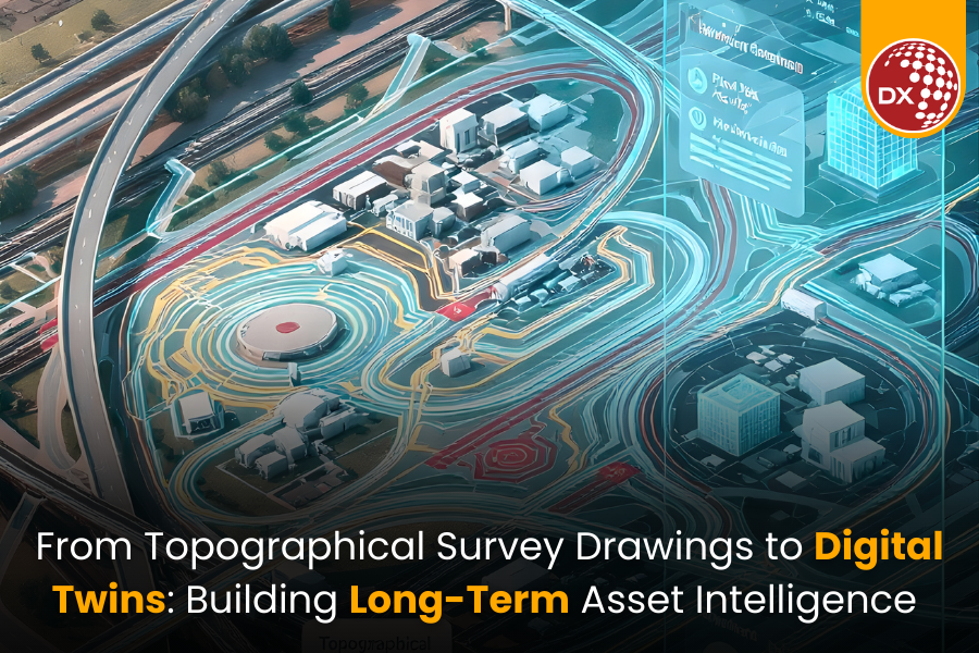
From Topographical Survey Drawings to Digital Twins: Building Long-Term Asset Intelligence
Key Takeaways
- Topographical Survey Drawings are the first layer of a digital twin, not just a pre-design formality.
- When captured as BIM- and GIS-ready data, topo surveys become a reusable asset for master planning, expansion, and scenario modeling.
- High-quality terrain data powers flood risk, drainage, and resilience simulations, instead of sitting as static PDFs.
- Linking topo data with BIM and Digital Twin platforms turns it into operational intelligence for inspections, O&M, and long-term asset decisions.
- Standardized, portfolio-wide survey practices help owners and agencies move faster up the digital twin maturity ladder and get more value from every new project.
Beyond “One-and-Done” Topo Surveys
For many developers, asset owners, and public agencies, Topographical Survey Drawings are treated as a pre-design checkbox.
You commission a survey, get a DWG and a PDF, design your project, and move on.
But if you’re talking about digital twins, you’re already thinking longer term. You want a living digital representation of your asset that supports planning, operations, resilience, and future expansion.
That digital twin doesn’t start with IoT sensors. It starts with the first time you measure the ground.
The question is: are your topographical surveys captured and structured in a way that your future digital twin can actually use?
Topographical Survey Drawings = Foundation Layer of the Twin
A digital twin is only as good as its base geometry and coordinate framework. That base doesn’t come from design intent; it comes from the real-world terrain and assets your project sits on.
Modern digital twins for infrastructure and cities depend heavily on:
- High-resolution topographic data
- Consistent coordinate systems and control
- Survey-grade elevation and feature mapping
- Integration with GIS and BIM environments
If your Topographical Survey Drawings are just flat 2D linework with unclear benchmarks, they limit what you can do later. If they are BIM-ready, geospatially robust, and properly attributed, they become the foundation of:
- Accurate terrain models
- Flood and drainage simulations
- Utility and corridor planning
- City- or campus-scale digital twins
Where Topo Data Adds Long-Term Value
1. Master Planning and Future Expansion
High-quality site topographic mapping and contour plans allow planners to:
- Evaluate multiple land-use and phasing options on real terrain
- Test different access roads, platforms, and grading schemes
- Preserve future expansion zones without creating hidden earthwork problems
In a digital twin, those same surfaces become the canvas for scenario modelling—what happens if you add another terminal, data hall, or warehouse block in 10 years?
2. Flood Risk and Climate Resilience
Recent digital twin pilots for cities and coastal assets show strong use of terrain and hydro data for flood modelling and resilience planning.
If your 2D and 3D topographical survey plans capture:
- Fine-level elevation changes
- Drainage channels and basins
- Shorelines, embankments, retaining systems
…those details enable your digital twin to run:
- Flood depth and extent simulations
- Stormwater performance tests
- “What-if” scenarios under future climate projections
This is impossible if the original survey is simplified, generalized, or locked away as a static PDF.
3. Operations, Inspections, and O&M Analytics
Digital twins are increasingly used for asset management, inspections, and predictive maintenance.
If your base terrain and as-built surveys are:
- Properly aligned to your asset registry
- Linked with building and network models
- Stored in a reusable BIM/GIS environment
Then you can:
- Plan safe access routes for inspections
- Understand where water will pond or scour
- Tie defects and incidents back to specific terrain conditions
Topographic data stops being “design history” and becomes part of the O&M intelligence layer.
Digital Twin Maturity: Where Topo Surveys Fit
Think of a simple digital twin maturity ladder:
1.Stage 0 – Isolated Files
a.Topo survey lives as a one-off DWG/PDF in a project folder.
2.Stage 1 – Connected BIM / GIS Base
a.BIM-ready Topographical Survey Drawings feed your BIM and GIS models.
b.Terrain is consistent across design disciplines.
3.Stage 2 – Program-Level Digital Twin
a.Multiple sites or corridors share common survey standards.
b.You can compare risk, flood, access, and capacity across assets.
4.Stage 3 – Live Asset Twin
a.Real-time or periodic monitoring (IoT, remote sensing) is layered on top of the survey-based geometry.
b.You can ask “what-if” questions about operations, resilience, and investment.
Your topographical survey strategy largely determines how fast you can move up that ladder.
What This Means for Developers, Owners, and Public Agencies
If you are commissioning surveys today, but talking about digital twins tomorrow, three action points matter:
- Specify BIM- and GIS-ready deliverables Ask for Topographical Survey Drawings in formats that support 3D surfaces, attributes, and coordinate metadata—not just 2D CAD.
- Standardize across your portfolio Use common layers, codes, and coordinate systems for every project. This turns individual surveys into a connected data asset for your entire estate or network.
- Choose partners who think beyond the current project Look for teams who understand both topographical survey drawing services and digital twin requirements, so every new survey strengthens your long-term asset intelligence.
How DGTRA Fits into This Picture
DGTRA sits at the intersection of:
- Topographical Survey Drawings and civil engineering
- BIM, VDC, and GIS integration
- Digital Twin support and implementation for owner-operators and infrastructure programs
We help you convert raw terrain data into BIM-ready, portfolio-consistent survey models that can plug directly into your digital twin roadmap—whether you are planning a single site, a campus, or a city-scale infrastructure program.
If you’re planning a digital twin initiative and want to ensure your next survey adds value for the next 30 years—not just the next 30 weeks—this is the moment to revisit how you brief, receive, and manage topographical data.
Contact us to get started: https://www.dgtra.com/contact/
Yes. High-quality topographic data forms the geometric foundation of any digital twin, enabling accurate simulations, planning, and long-term asset intelligence.
A BIM/GIS-ready survey includes proper coordinate systems, attributed features, 3D surfaces, and structured layers that can be directly integrated into BIM, GIS, and digital twin workflows.
To a certain extent, yes. DGTRA can convert legacy surveys into standardized, geospatially aligned models—but fresh, BIM-ready capture always yields the best results.
Detailed elevation, drainage patterns, and hydro features allow digital twins to run flood simulations, stormwater performance tests, and climate-risk scenarios.
Standardization ensures every new survey contributes to a unified, portfolio-wide data asset, enabling multi-site comparisons, better planning, and accelerated digital twin maturity.