

The global architecture, engineering, and construction (AEC) sector is undergoing a significant transformation. Project value now depends on data connectivity, predictive insights, and the integration of physical and digital environments. Project owners and engineering executives face the challenge of scaling operational intelligence throughout the asset lifecycle. An International Data Corporation (IDC) report notes the AEC sector is moving from fragmented software pilots to robust data governance, organizational enablement, and enhanced decision-making. By adopting Digital Twins, Artificial Intelligence (AI), and Virtual Design and Construction (VDC) technologies, leading firms are eliminating project disconnects and achieving greater margin predictability. Executive Summary: The Connected Construction Paradigm The Core Shift: Transitioning from isolated, model-based drafting to an integrated digital thread throughout the asset lifecycle. The AI Impact: Moving from reactive clash detection to automated, rule-based conflict resolution and predictive analytics. The Operational Value: Transforming static as-built deliverables into dynamic, IoT-enabled Digital Twins that significantly reduce lifecycle operating costs. 1. Connected Construction: Building the Digital Thread Connected construction is central to modern project delivery, enabling a continuous flow of structured information from early planning to daily facility management. In the past, critical asset data was often lost during fragmented handoffs between designers, contractors, and owners. Robust information management frameworks, based on international standards such as ISO 19650, address this data loss. Establishing a unified Common Data Environment (CDE) and strict data schemas enables project teams to create a reliable digital thread. This connected data foundation ensures that all stakeholders, from field superintendents to asset operators, access a single, reliable source of information in real time. 2. AI-Assisted Coordination & Predictive Analytics Traditional coordination processes are reactive, requiring design teams to spend significant time manually filtering clash reports or responding to RFIs after issues arise. AI in construction shifts this approach from damage control to proactive prevention. AI-Assisted Coordination A global McKinsey & Company analysis notes that advanced organizations are redefining workflows by treating AI as an autonomous teammate rather than a simple tool. In VDC, machine learning algorithms automate administrative tasks in clash resolution. AI routines group geometric conflicts by system or trade, filter out false positives, and route actionable tasks directly to responsible engineers. Predictive Analytics By analyzing current model data with historical project performance, predictive models assess schedule risks, anticipate supply chain bottlenecks, and identify potential cost overruns before construction begins. Addressing these issues early allows leadership to mitigate design and logistical risks before they escalate. 3. Reality Capture: The Critical Validation Layer A digital model is valuable only when it accurately reflects site conditions. Modern VDC workflows use advanced reality capture technologies, such as terrestrial laser scanners, drone photogrammetry, and robotic total stations, to continuously audit the physical build. Point cloud data captured in the field is overlaid on the coordinate model. Automated compliance scripts cross-check tolerances, verify installation accuracy, and identify deviations. This precise validation process removes reliance on subjective field logs, ensuring structural issues are detected and corrected before downstream trades begin work. 4. Digital Twins and Asset Lifecycle Intelligence The next stage of connected construction is moving from a static as-built model to a dynamic Digital Twin. A digital twin bridges the physical and digital environments by continuously collecting live data from building management systems, IoT sensors, and operational meters. This shift delivers significant financial and operational benefits. Research published by MDPI shows that advanced digital twin implementations can reduce maintenance costs by 10% to 25% and energy consumption by 15% to 30%. Capability Traditional VDC / BIM AI-Driven Connected Twins Data Structure Static, file-based models (PDFs, native files) Continuous, live-streaming data architecture Coordination Manual clash matrices and weekly review logs Automated AI filtering and automated task routing Field Verification Subjective daily logs and manual inspections Millimeter-accurate laser scanning and reality capture Lifecycle Utility Concludes at the post-construction handoff Extends indefinitely across the operational lifecycle This live integration extends the value of VDC throughout the asset lifecycle. Facility operations teams gain a unified interface to run predictive maintenance, optimize resource use, and significantly reduce operating costs. About DGTRA Consultancy DGTRA Consultancy Private Limited is a leading global Digital Engineering and BIM Consulting firm, transforming information management across the Architecture, Engineering, Construction, Infrastructure, and Owner-Operator (AECO) sectors. Based in Pune, India, DGTRA serves as a trusted digital delivery partner for clients in North America, Europe, the United Kingdom, Australia, and the Middle East. With deep technical expertise and a mature Information Management System, independently re-certified under ISO 19650 by the British Standards Institution (BSI), DGTRA supports complex capital infrastructure projects in commercial developments, data centers, aviation, transit, and healthcare. DGTRA designs and implements custom automation pipelines, end-to-end Common Data Environment (CDE) setups, precise reality capture workflows, and lifecycle-ready Digital Twins, enabling clients to achieve project certainty. Discover how DGTRA delivers enterprise-grade project certainty through tailored BIM Consulting and Management Services, as well as advanced operational frameworks for Owner-Operator Digital Solutions. Frequently Ask Quetions (FAQ) Does COBie require a 3D BIM model to work? No. COBie is purely data, not geometry. While it is usually exported directly from software like Revit, you can technically build a COBie sheet in Excel by hand. It cares about what the equipment is and where it is, not what it looks like in 3D. If it’s just an Excel sheet, why can’t we just make our own? Because custom spreadsheets lack a unified schema. COBie’s strict, standardized column headers and tab structures are universally readable. Because it follows an exact international standard, major facility management platforms (like Maximo or Archibus) can ingest it automatically with zero custom mapping. Who is actually responsible for entering the COBie data? It’s a relay race. Designers populate spatial data (floors, spaces, types) during design. Contractors fill in the dynamic asset metadata (serial numbers, installation dates, warranties) during construction. The BIM manager or VDC consultant typically orchestrates the final verification. What is the difference between COBie and IFC? IFC (Industry Foundation Classes) handles everything in a building model, including complex 3D shapes, walls, and geometry. COBie is a subset of IFC that completely
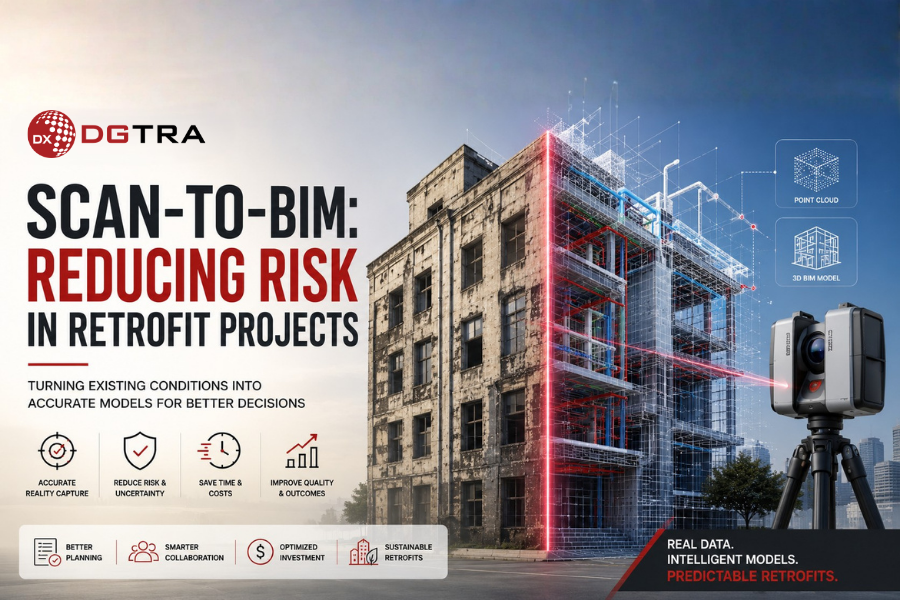
Scan-to-BIM: Reducing Risk in Retrofit Projects
Reimagining an existing building is one of the most rewarding endeavors in modern architecture. Across major metropolitan hubs in India, historic quarters in the UK, and rapidly modernizing districts in the Middle East, retrofit projects represent a powerful intersection of heritage, sustainability, and technological innovation. When we choose to update and revitalize an established structure, we breathe new life into carbon-heavy assets, turning legacy materials into modern, high-performance environments. In our previous discussion on Why Renovation Projects Excel with Accurate As-Built Data, we established that establishing an undeniable spatial baseline is the key to bypassing coordination friction. For complex retrofits, the next step is building a structured reality-capture framework that turns structural and MEP unknowns into precise engineering assets. Operating with this heightened level of physical certainty allows developers, design-build teams, and contractors to protect project margins, streamline compliance, and execute complex modernizations with complete peace of mind. The Strategic Alignment of Retrofit Modernization The global drive toward high-performance building upgrades are accelerating rapidly. According to the UNEP Global Status Report for Buildings and Construction 2025-2026, nearly half of the buildings that will exist in 2050 are already built, highlighting building renovation and energy-efficient retrofitting as major pillars of global urban resilience. At the same time, regional market dynamics—such as compliance demands under India’s evolving Energy Conservation Building Codes (ECBC) and Saudi Arabia’s ambitious Vision 2030 digital construction mandates—are encouraging AECO leaders to upgrade older structural envelopes into smart, energy-efficient spaces. In this context, relying on speculative paper archives or unverified CAD files introduces avoidable execution variance. Buildings naturally settle over decades, structural columns deflect under load, and previous operational upgrades are rarely documented with millimetre accuracy. By integrating modern BIM Consulting & Management early in your pre-construction phase, you transition from guesswork to mathematical precision. A 2026 market evaluation by Fortune Business Insights indicates that integrating cloud-based BIM systems with active design validation improves multidisciplinary coordination efficiency by upwards of 25%, allowing project teams to allocate resources with perfect clarity. The De-Risking Pipeline: Elevating Brownfield Delivery De-risking a complex retrofit is not about reacting to physical challenges as they appear on-site; it is about establishing a systematic, multi-stage data verification process. When we map building realities before finalizing design details, we replace uncertainty with actionable insights. The structured Scan-to-BIM pipeline below shows how leading delivery teams align legacy conditions with modern digital requirements: Enabling Seamless Prefabrication and Quality Assurance Starting your retrofit with high-accuracy spatial coordinates drastically improves procurement speed and offsite construction efficiency. In modern developments, pre-fabricating complex mechanical modules, structural reinforcement brackets, or custom facade panels offsite saves substantial time and minimizes material waste. When your fabrication drawings are driven directly by a millimeter-accurate Scan-to-BIM model, you can proceed with the certainty that every component will install smoothly on-site. This coordinated process ensures that multidisciplinary teams—from structural consultants to specialty HVAC installers—work from a single, verified data source. To explore how standardized information management frameworks streamline complex handovers across international borders, view our resource library on the DGTRA Insights Portal. Linking Real-World Assets to Digital Twin Operations Beyond the immediate advantages during design and construction, a precise Scan-to-BIM model serves as the digital bedrock for long-term operational excellence. When the retrofit is complete, the as-built model transitions into a highly reliable database for Digital Twin Solutions. By linking real-world IoT sensor networks with the spatial architecture of your BIM model, asset managers can monitor energy consumption, track building occupant patterns, and perform predictive maintenance with maximum ease. Register for Our Upcoming Technical Session Ready to see how Scan-to-BIM workflows are implemented on active brownfield sites to optimize project margins? Register for our upcoming live webinar: “What’s Hiding Behind Your Existing Drawings? How Scan-to-BIM Reduces Renovation Risk, Rework, and Costly Surprises.” Learn directly from our senior digital engineers as they present real-world case studies on streamlining spatial validation and maximizing procurement margins. Register for the Live Technical Webinar Today How does Scan-to-BIM improve retrofit project schedules? By capturing precise existing conditions during the pre-construction phase, the design team can identify and resolve spatial clashes virtually. This prevents design re-work and physical coordination delays once construction begins, keeping the project on a predictable, fast-track timeline. How do we handle spaces hidden behind finished walls or ceilings? We combine terrestrial laser scanning of exposed structural systems with non-destructive methods (like GPR) and historic documentation to build an informed, comprehensive digital representation of internal services and hidden structural components. Is Scan-to-BIM suitable for active, occupied facilities? Absolutely. Modern laser scanning is completely non-contact and quiet. Scanning technicians can capture millions of data points rapidly during off-peak hours, ensuring ongoing business operations or tenant experiences remain completely unaffected. How does Scan-to-BIM support environmental and energy retrofit goals? Precise models allow engineers to accurately run building envelope simulations, trace thermal leaks, and plan the integration of highly efficient HVAC and solar retrofit systems, helping properties achieve prestigious green building certifications. Can the resulting BIM model be directly integrated into existing facilities management software? Yes. We build models in compliance with open standards (such as COBie and IFC). This ensures that spatial layouts and asset parameters transition smoothly into active facilities management databases and predictive maintenance systems. By capturing precise existing conditions during the pre-construction phase, the design team can identify and resolve spatial clashes virtually. This prevents design re-work and physical coordination delays once construction begins, keeping the project on a predictable, fast-track timeline. We combine terrestrial laser scanning of exposed structural systems with non-destructive methods (like GPR) and historic documentation to build an informed, comprehensive digital representation of internal services and hidden structural components. Absolutely. Modern laser scanning is completely non-contact and quiet. Scanning technicians can capture millions of data points rapidly during off-peak hours, ensuring ongoing business operations or tenant experiences remain completely unaffected. Precise models allow engineers to accurately run building envelope simulations, trace thermal leaks, and plan the integration of highly efficient HVAC and solar retrofit systems, helping properties achieve prestigious green building certifications. Yes. We build models
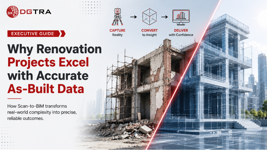
Why Renovation Projects Excel with Accurate As-Built Data
The defining moment of a building renovation rarely happens in the design studio; it happens during initial demolition. Every project team knows the sudden quiet on a job site when a wall comes down to reveal a structural column or a major mechanical run that never appeared on any historical blueprint. When teams rely on outdated legacy drawings, they are essentially modeling a hypothetical asset. The secret to bypassing this friction entirely is anchoring design decisions in absolute physical truth. The traditional approach to retrofitting existing structures often treats site uncertainty as an unavoidable project variable. However, shifting the workflow toward precise reality capture transforms these unpredictable hurdles into clear, manageable development advantages. Starting your pre-construction phase with an accurate, high-fidelity digital baseline allows you to plan layout reconfigurations, structural alterations, and complex system upgrades with complete confidence and total design freedom. The Strategic Premium of Real-World Data Fidelity Relying on old paper archives or unverified CAD exports is rapidly becoming a liability for forward-thinking design and construction teams. Buildings are living structures that undergo decades of unrecorded modifications, structural shifts, and localized tenant fit outs. Attempting to design a modern, high-performance space on top of speculative measurements introduces compounding layout adjustments during construction. When you anchor your workflow in highly detailed as-built models, you eliminate the margin of error that typically derails fast-track retrofits. According to a 2026 industry capability report from the building SMART international data index, engineering teams that mandate open-standard as-built validation models at project kickoff experience a massive reduction in unexpected field coordination clashes and field resource waste. This data-first approach shifts the entire construction conversation from reactive problem-solving to structured, predictable execution. Furthermore, precision spatial frameworks are essential for meeting today’s tight performance targets. A recent 2026 market analysis published by Research and Markets indicates that the global digital twin market has climbed significantly, driven by asset owners demanding perfect structural-to-digital alignment at handover. Having clean, reliable data from day one ensures your design functions flawlessly in the real world and transitions perfectly into long-term facility management. Moving Beyond the Blueprint: The Reality Capture Workflow Embracing a modern verification pipeline changes your entire project timeline. Instead of manually cross-referencing mismatched dimensions, teams can implement a reliable, multi-stage data alignment workflow: 1.Field Laser Scanning: Zero-Disruption Reality Capture. High-speed terrestrial scanners and drone sensors capture the exact coordinates of every visible structural, architectural, and MEP element without disrupting ongoing facility operations. 2.Point Cloud Registration: Unified Spatial Coordinate Map. Individual field scans are indexed and registered into a comprehensive, millimetres-accurate 3D point cloud, creating a complete digital twin of the current building reality. 3.Scan-to-BIM Transformation: Parametric Geometry Mapping. Modeling teams translate the raw point cloud into a clean, data-rich intelligent model. Every wall, conduit, and beam is mapped to its exact spatial location, creating a true foundation for your new design. Cultivating Long-Term Asset Value and Predictable Procurement Starting a project with verified structural data does more than just protect the pre-construction phase; it directly improves procurement accuracy. Exact dimensions mean that your 5D quantity takeoffs and material orders match site requirements perfectly. This allows you to pre-fabricate complex mechanical assemblies off-site with absolute certainty that they will fit into place on delivery day. This unified approach brings immense clarity to every stakeholder, keeping projects moving forward smoothly. To explore how clear information management principles elevate complex structural handovers across global projects, read our strategic insights on optimizing your digital pipelines through the DGTRA Insights Portal. Upcoming Live Technical Webinar Want to see exactly how these data workflows operate on active job sites? Register for our upcoming live webinar: “What’s Hiding Behind Your Existing Drawings? How Scan-to-BIM Reduces Renovation Risk, Rework, and Costly Surprises.” Discover practical, real-world case studies on how reality capture protects project margins and streamlines design approvals. Reserve Your Complimentary Webinar Seat Now About DGTRA DGTRA is a leading digital transformation partner and process-driven management consultancy operating at the global forefront of the AECO industry. Supported by an elite team of over 100 specialized professionals, we bridge the gap between advanced digital technology and practical, profitable execution across India, the UK, and the Middle East. We partner directly with asset owners, tier-1 contractors, and premier design firms to build dependable, forward-thinking digital roadmaps. Our deep domain expertise spans advanced BIM Consulting & Management frameworks, precise asset information modeling, and the practical deployment of operational digital twins. At DGTRA, our guiding principle remains absolute: we engineer the digital processes that bring total predictability, structural transparency, and financial certainty to ambitious construction programs worldwide. Ready to eliminate data gaps and secure your project margins? Schedule a strategic consultation with a DGTRA Process Specialist today. Frequently Asked Questions (FAQ) Why do standard manual measurements fall short in building renovations? Manual field measurements capture isolated dimensions but often miss wall deviations, ceiling deflections, and hidden mechanical runs. Reality capture records millions of data points simultaneously, providing a holistic and flawless digital map of the entire space. At what point should Scan-to-BIM happen in a project timeline? Reality scanning delivers the highest return on investment when completed before any design decisions begin. This ensures the design team develops their concepts on a true architectural foundation, preventing late-stage alterations. How does accurate model data speed up municipal design approvals? Zoning boards and building departments review verified data configurations much faster. Providing an undeniable, reality-checked model demonstrates total structural compliance from your very first submission. Can laser scanning capture utilities hidden behind finished walls? Laser scanning documents exposed systems perfectly. For enclosed areas, engineers combine selective scanning with historical records or non-destructive radar to map structural paths accurately within the final model blueprint. How do clean as-built models support future digital twin setups? An accurate model acts as the baseline database for an operational digital twin. Populating the asset parameters early allows owners to connect live building sensors directly to a clean spatial map for efficient facilities management. Manual field measurements capture isolated dimensions but often miss wall deviations, ceiling deflections, and
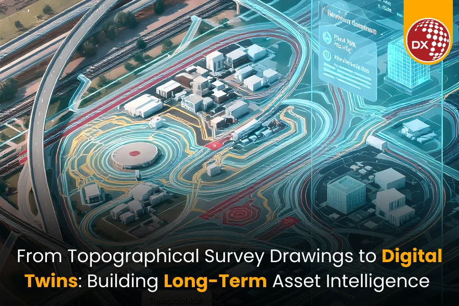
From Topographical Survey Drawings to Digital Twins: Building Long-Term Asset Intelligence
From Topographical Survey Drawings to Digital Twins: Building Long-Term Asset Intelligence Key Takeaways Topographical Survey Drawings are the first layer of a digital twin, not just a pre-design formality. When captured as BIM- and GIS-ready data, topo surveys become a reusable asset for master planning, expansion, and scenario modeling. High-quality terrain data powers flood risk, drainage, and resilience simulations, instead of sitting as static PDFs. Linking topo data with BIM and Digital Twin platforms turns it into operational intelligence for inspections, O&M, and long-term asset decisions. Standardized, portfolio-wide survey practices help owners and agencies move faster up the digital twin maturity ladder and get more value from every new project. Beyond “One-and-Done” Topo Surveys For many developers, asset owners, and public agencies, Topographical Survey Drawings are treated as a pre-design checkbox. You commission a survey, get a DWG and a PDF, design your project, and move on. But if you’re talking about digital twins, you’re already thinking longer term. You want a living digital representation of your asset that supports planning, operations, resilience, and future expansion. That digital twin doesn’t start with IoT sensors. It starts with the first time you measure the ground. The question is: are your topographical surveys captured and structured in a way that your future digital twin can actually use? Topographical Survey Drawings = Foundation Layer of the Twin A digital twin is only as good as its base geometry and coordinate framework. That base doesn’t come from design intent; it comes from the real-world terrain and assets your project sits on. Modern digital twins for infrastructure and cities depend heavily on: High-resolution topographic data Consistent coordinate systems and control Survey-grade elevation and feature mapping Integration with GIS and BIM environments If your Topographical Survey Drawings are just flat 2D linework with unclear benchmarks, they limit what you can do later. If they are BIM-ready, geospatially robust, and properly attributed, they become the foundation of: Accurate terrain models Flood and drainage simulations Utility and corridor planning City- or campus-scale digital twins Where Topo Data Adds Long-Term Value 1. Master Planning and Future Expansion High-quality site topographic mapping and contour plans allow planners to: Evaluate multiple land-use and phasing options on real terrain Test different access roads, platforms, and grading schemes Preserve future expansion zones without creating hidden earthwork problems In a digital twin, those same surfaces become the canvas for scenario modelling—what happens if you add another terminal, data hall, or warehouse block in 10 years? 2. Flood Risk and Climate Resilience Recent digital twin pilots for cities and coastal assets show strong use of terrain and hydro data for flood modelling and resilience planning. If your 2D and 3D topographical survey plans capture: Fine-level elevation changes Drainage channels and basins Shorelines, embankments, retaining systems …those details enable your digital twin to run: Flood depth and extent simulations Stormwater performance tests “What-if” scenarios under future climate projections This is impossible if the original survey is simplified, generalized, or locked away as a static PDF. 3. Operations, Inspections, and O&M Analytics Digital twins are increasingly used for asset management, inspections, and predictive maintenance. If your base terrain and as-built surveys are: Properly aligned to your asset registry Linked with building and network models Stored in a reusable BIM/GIS environment Then you can: Plan safe access routes for inspections Understand where water will pond or scour Tie defects and incidents back to specific terrain conditions Topographic data stops being “design history” and becomes part of the O&M intelligence layer. Digital Twin Maturity: Where Topo Surveys Fit Think of a simple digital twin maturity ladder: 1.Stage 0 – Isolated Files a.Topo survey lives as a one-off DWG/PDF in a project folder. 2.Stage 1 – Connected BIM / GIS Base a.BIM-ready Topographical Survey Drawings feed your BIM and GIS models. b.Terrain is consistent across design disciplines. 3.Stage 2 – Program-Level Digital Twin a.Multiple sites or corridors share common survey standards. b.You can compare risk, flood, access, and capacity across assets. 4.Stage 3 – Live Asset Twin a. Real-time or periodic monitoring (IoT, remote sensing) is layered on top of the survey-based geometry. b. You can ask “what-if” questions about operations, resilience, and investment. Your topographical survey strategy largely determines how fast you can move up that ladder. What This Means for Developers, Owners, and Public Agencies If you are commissioning surveys today, but talking about digital twins tomorrow, three action points matter: Specify BIM- and GIS-ready deliverables Ask for Topographical Survey Drawings in formats that support 3D surfaces, attributes, and coordinate metadata—not just 2D CAD. Standardize across your portfolio Use common layers, codes, and coordinate systems for every project. This turns individual surveys into a connected data asset for your entire estate or network. Choose partners who think beyond the current project Look for teams who understand both topographical survey drawing services and digital twin requirements, so every new survey strengthens your long-term asset intelligence. How DGTRA Fits into This Picture DGTRA sits at the intersection of: Topographical Survey Drawings and civil engineering BIM, VDC, and GIS integration Digital Twin support and implementation for owner-operators and infrastructure programs We help you convert raw terrain data into BIM-ready, portfolio-consistent survey models that can plug directly into your digital twin roadmap—whether you are planning a single site, a campus, or a city-scale infrastructure program. If you’re planning a digital twin initiative and want to ensure your next survey adds value for the next 30 years—not just the next 30 weeks—this is the moment to revisit how you brief, receive, and manage topographical data. Contact us to get started: https://www.dgtra.com/contact/ Are Topographical Survey Drawings really important for digital twins? Yes. High-quality topographic data forms the geometric foundation of any digital twin, enabling accurate simulations, planning, and long-term asset intelligence. What makes a topo survey “BIM- or GIS-ready”? A BIM/GIS-ready survey includes proper coordinate systems, attributed features, 3D surfaces, and structured layers that can be directly integrated into BIM, GIS, and digital twin workflows. Can existing 2D topo surveys be upgraded for digital twin use? To a certain extent, yes. DGTRA can convert legacy surveys into standardized, geospatially aligned models—but fresh, BIM-ready capture always yields the best results. How does topo data support flood resilience and climate modeling? Detailed elevation, drainage patterns, and hydro