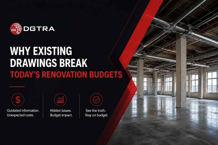
Why Existing Drawings Break Today’s Renovation Budgets
About This Article
This article examines why relying on legacy 2D CAD files and historical as-built drawings creates operational risk for major renovation and brownfield projects. It outlines how physical build drift, unrecorded alterations, and missing spatial context lead to unplanned field rework, schedule extensions, and budget growth.
It explains how project directors, EPC contractors, and asset owners can validate existing conditions using Scan-to-BIM for renovation projects and Reality Capture workflows to establish accurate site data before design and procurement begin.
Why Renovation Projects Are Becoming More Complex
Renovation, expansion, and brownfield redevelopments account for an increasing share of global capital expenditure. Driven by sustainability mandates, urban land constraints, and industrial modernization, project teams are tasked with inserting complex new systems into existing assets.
However, managing a renovation inside an operating facility or historical structure introduces risks that do not exist in greenfield construction. Existing structural constraints, dense mechanical, electrical, and plumbing (MEP) routing, and active tenant or production operations leave zero margin for spatial error.
A single unmapped pipe riser or unrecorded beam splice can halt site installation, force emergency field redesigns, and delay commissioning schedules.
Existing Drawings Tell Only Part of the Story
The primary source of risk in brownfield delivery stems from an institutional reliance on legacy documentation. Project leaders often assume that historical CAD files, original paper blueprints, or previous operational submittals accurately represent site conditions.
In practice, existing drawings depict design intent, not physical reality.
Over decades of asset operation, facilities undergo undocumented modifications, emergency maintenance repairs, and minor spatial adjustments that are rarely recorded back into master drawings. Structural settlement, thermal movement, and tolerance stack-up further separate physical conditions from two-dimensional paper records.
Research from the National Institute of Standards and Technology (NIST) showed that inadequate interoperability and inaccurate asset documentation cost the U.S. capital facilities industry $15.8 billion annually, with two-thirds of those costs borne by asset owners during ongoing facility operations and retrofit phases.
When engineering teams design new structural additions or prefabricated piping spools using unverified drawings, they design against assumptions. When those assumptions meet physical reality during installation, the cost of correction multiplies.
Comparing Legacy Drawings vs. Verified Reality Capture
- Data Basis: Legacy drawings rely on historical design intent and manual field measurements. Reality capture builds on high-density 3D spatial point clouds.
- Accuracy Level: Legacy drawings offer inferred dimensions subject to cumulative field drift. Reality capture provides millimeter-level geometric measurement.
- Spatial Completeness: Legacy drawings show selective 2D planes, sections, and callouts. Reality capture captures comprehensive 3D spatial geometry.
- Clash Identification: Legacy workflows discover clashes reactively during site installation. Reality capture identifies clashes proactively in a digital model.
- Rework Risk: Legacy approaches carry high rework risks with potential field cuts. Reality capture keeps rework low while supporting off-site pre-fabrication.
Why Existing Conditions Matter More Than Ever
In modern project delivery, the financial consequences of inaccurate site documentation have escalated due to three industry trends:
- Off-Site Modular Pre-fabrication: To mitigate labor shortages and control quality, contractors pre-fabricate MEP modules, structural skids, and curtain wall panels in off-site facilities. These assemblies require exact field tie-in dimensions. If jobsite anchors or connection flanges differ from the drawing by even 15 millimeters, the prefabricated assembly cannot be installed without field modification.
- Accelerated Downtime Windows: Industrial plants, hospital wings, and airport terminals operate under strict outage windows. Every hour a production line or operating room remains closed for unforeseen structural modifications costs thousands in lost operational revenue.
- Complex Regulatory & Safety Constraints: Retainage of structural integrity, fire compartmentation, and environmental compliance during brownfield modifications requires clear knowledge of existing load-bearing members and utility pathways.
Analysis published by McKinsey & Company notes that construction productivity globally has suffered due to inefficient operational practices, with capital projects routinely experiencing cost escalation and schedule creep. Replacing inferred site conditions with verified geometric data is a direct operational lever to recover project predictability.
How Reality Capture Creates Better Project Visibility
Reality Capture addresses the limitations of legacy documentation by collecting precise physical spatial data across an asset using high-definition 3D laser scanners, mobile mapping systems, and terrestrial photogrammetry.
Instead of relying on manual tape measurements, plumb lines, or selective site inspections, laser scanners capture millions of coordinate points per second to generate an accurate 3D “point cloud.”
This point cloud creates a digital record of all visible structural components, MEP systems, architectural contours, and equipment placements down to millimeter accuracy.
By integrating high-resolution reality capture into early project planning, project teams gain:
- Complete Spatial Context: Access to full 3D visual and geometric records of ceiling voids, congested mechanical shafts, and structural bays without repeated, intrusive physical site visits.
- Verified Tolerances: Clear visibility into floor flatness, wall plumbness, structural deflection, and pipe slope variations that 2D drawings fail to convey.
- Clash-Free Coordination: The ability to run automated clash detection algorithms between proposed 3D design models and actual, physical site geometry.
Scan-to-BIM: Turning Existing Conditions into Actionable Information
A raw point cloud contains accurate spatial coordinates, but engineering and design teams require intelligent, parametric data to build construction documentation.
Scan-to-BIM is the process of translating 3D point cloud data into structured, intelligent parametric models (such as Autodesk Revit) governed by established Level of Development (LOD) and Level of Information (LOI) standards.
Through Scan-to-BIM for renovation projects, unstructured spatial measurements are converted into parametric elements—walls, beams, ducts, conduits, valves, and structural footings.
According to a research firms integrating reality capture and advanced 3D coordination workflows experience up to a 73% reduction in errors and rework during field execution.
By replacing manual field assumptions with a verified as-built BIM model, design teams resolve spatial conflicts inside the digital model long before materials are ordered or trade crews mobilize.
Where Reality Capture Delivers the Greatest Value
While reality capture benefits most brownfield environments, specific asset sectors experience an elevated return on investment due to operational complexity and spatial density:
Healthcare Facilities & Hospitals
Renovating operating suites, imaging rooms, or HVAC infrastructure inside active hospitals requires surgically precise installation. Unmapped medical gas lines, electrical conduits, or structural supports above drop ceilings present critical operational hazards. Scan-to-BIM maps congested interstitial spaces, allowing new equipment to be installed without interrupting surrounding clinical operations.
Industrial Facilities & Manufacturing Plants
Brownfield expansions in chemical plants, pharmaceutical facilities, and manufacturing sites involve dense piping networks, structural skids, and heavy machinery tie-ins. High-definition laser scanning captures exact flange locations, pipe slopes, and valve clearances, enabling off-site pre-fabrication of replacement spools and reducing facility turnaround downtime.
Data Centres
Data centre retrofits require upgrading cooling capacity and electrical distribution within tightly constrained white-space environments. Reality capture verifies server rack clearances, cable tray pathways, and overhead duct space to prevent thermal short-circuiting and installation delays.
Commercial Renovations & Historical Buildings
Historical structures rarely possess accurate, up-to-date drawings. Walls are out of plumb, floors exhibit structural sag, and structural modifications have accumulated over generations. Scan-to-BIM captures intricate architectural detail, structural geometry, and facade variations, ensuring structural additions integrate with historical building fabrics.
Infrastructure, Airports & Universities
Large-scale public infrastructure retrofits—such as airport terminal upgrades, railway station modernization, and university campus utility replacements—benefit from wide-area reality capture. Mobile mapping and terrestrial scanning establish accurate ground, utility, and structural baselines across sprawling assets without disturbing transit flows or campus operations.
Better Information Leads to Better Decisions
Relying on existing, unverified drawings is an operational risk that modern projects no longer need to accept.
When project leaders invest in validating existing conditions early through reality capture and Scan-to-BIM, the focus shifts from reactive field troubleshooting to proactive digital execution:
- Design teams design against verified site measurements rather than assumed drawings.
- Procurement teams order materials and pre-fabricated assemblies with dimensional confidence.
- Construction managers coordinate trade sequences without encountering spatial surprises on site.
- Asset owners receive an accurate Digital Twin baseline for long-term facilities management.
Better spatial information at the outset of a project leads to safer construction, predictable budgets, and reliable delivery dates.
Key Takeaways
Drawings represent intent, not reality:
Legacy drawings fail to record cumulative structural settlement, field modifications, and unrecorded maintenance alterations.
Scan-to-BIM mitigates field rework:
Converting point cloud data into parametric BIM models allows teams to resolve spatial clashes digitally before site mobilization.Pre-fabrication requires millimeter accuracy:
Modern off-site modular construction relies on verified tie-in points that 2D paper drawings cannot reliably supply.ISO 19650 alignment:
Managing as-built information within a structured Common Data Environment (CDE) under ISO 19650 frameworks ensures long-term asset data integrity.
Frequently Asked Questions (FAQs)
What is Scan-to-BIM?
Scan-to-BIM is the technical process of using 3D laser scanning technology to capture precise physical site conditions as a point cloud, which is then modeled into an intelligent, parametric 3D Building Information Model (BIM) using software platforms like Autodesk Revit.
Why are existing drawings often inaccurate?
Existing drawings typically depict original design intent rather than what was physically built. Over an asset’s lifecycle, undocumented repairs, minor tenant fit-outs, structural settling, and unrecorded emergency revisions create significant gaps between drawing sheets and physical site geometry.
When should laser scanning be used on a renovation project?
Laser scanning should be performed during the initial site assessment and feasibility phase—prior to detailed design and engineering work. Capturing verified site conditions early prevents design revisions, inaccurate material callouts, and costly change orders during site execution.
What industries benefit most from Reality Capture?
Industries with high spatial density, strict operational uptime constraints, or complex MEP routing benefit most. Key sectors include industrial manufacturing, oil and gas, healthcare facilities, data centres, commercial real estate, historical preservation, and public infrastructure.
How accurate is Reality Capture technology?
Terrestrial laser scanners typically achieve millimeter-level accuracy (often within ±1 mm to ±3 mm depending on distance, surface reflectance, and hardware specification), providing a far more reliable baseline than manual field measurements or legacy CAD drawings.
How is Scan-to-BIM different from traditional surveying?
Traditional land surveying collects discrete single-point measurements (x, y, z coordinates) using total stations or GPS. Scan-to-BIM uses high-speed laser scanners to capture millions of spatial points per second, generating a dense 3D visual and geometric representation of all visible physical elements across an entire asset.
About DGTRA
DGTRA Consultancy is an independent digital engineering and technical consulting firm. We specialize in Virtual Design & Construction (VDC), BIM consultancy, Scan-to-BIM for renovation projects, Project Controls, Integrated Project Delivery, and ISO 19650 Advisory.
DGTRA supports project owners, EPC managers, architects, and general contractors by establishing structured data governance, validating existing site conditions, and optimizing digital workflows to ensure capital delivery certainty across global building and infrastructure portfolios.
Conclusion & Next Steps
Relying on legacy paper drawings for complex brownfield developments introduces unnecessary risk to project budgets and schedules. Validating existing physical conditions with 3D laser scanning and Scan-to-BIM establishes a single source of spatial truth that protects project margins and handover deadlines.
Validate Your Existing Site Conditions
To discuss how early reality capture and structured Scan-to-BIM workflows can establish certainty for your upcoming renovation or brownfield project, connect with DGTRA’s digital engineering advisory team.
👉 Contact DGTRA’s Digital Engineering Team
👉 Explore DGTRA’s Full Suite of Scan-to-BIM Services
👉 Learn More About Our ISO 19650 Advisory & Data Governance